Come along with our Visitor Information Centre (VIC) Tour Guide and enjoy one of the many picturesque walks around historic Port Fairy.
Located across the bridge from Port Fairy’s picturesque harbour, Battery Hill is worthy of exploration. Why was a Battery and Garrison established in Port Fairy? In the nineteenth century, the colonial government was concerned about the wars raging in Europe. It was felt that, as a consequence of these wars, there was a real threat of invasion of the colony in Australia. In Victoria, the government believed the main ports along the southern coast were vulnerable to attack from the sea, principally from Russian warships. Consequently, a network of permanent fortifications was established along the southern coast to defend these ports.
These fortifications in Port Fairy, Portland and Warrnambool were intended to “act as a powerful deterrent to attack by hostile warships”. A variety of cannons were positioned in Port Fairy to protect the town from this perceived threat.
“The Port Fairy Visitor Information Centre acknowledges Australia’s First Nations Peoples as the traditional owners and custodians of this land and gives respect to the Elders, past and present, and through them to all Australian Aboriginal and Torres Strait Islander People.”

In January, each year this cannon on the top of Battery Hill is fired every Sunday morning to celebrate the new year and share with locals and visitors the story of Battery Hill in Port Fairy’s history. Although – I hasten to add – the cannon doesn’t fire a 36-kilogram shell!
If it did your leisurely stroll round Griffiths Island might be rudely interrupted. Or some fishing boats and pleasure craft sailing near Griffiths Island might not be returning to the wharf!
If you would like to find out more about Port Fairy’s Battery Hill, its concrete gun emplacements, armories and powder magazine, and who was responsible for their operation and maintenance, you don’t have to wait for a Sunday morning in January. Instead, come along on this virtual walk — it will give you a blast from the past!
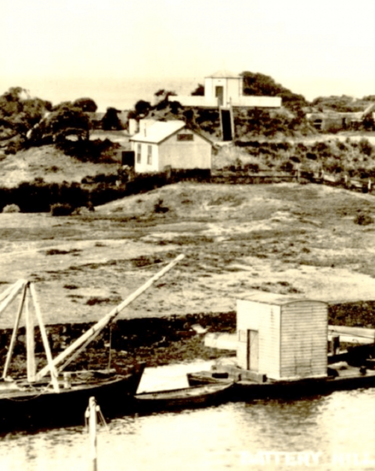
 Interspersed amongst recently taken photographs along the route to and from Battery Hill is a selection of old photographs and postcards kindly provided by the Port Fairy Historical Society. They’ll help you visualise what Battery Hill was originally like and how it has changed over time. This postcard of Battery Hill showing the lookout and concrete emplacement is an early example. It’s very different from how Battery Hill looks today.
We start our tour outside the VIC. On our way to Battery Hill we’ll stop to look at places along the way that give us brief insights into other aspects of Port Fairy’s history.
Of course, you don’t have to start here — you can join our walk anywhere along the path to Battery Hill and the mouth of the Moyne River.
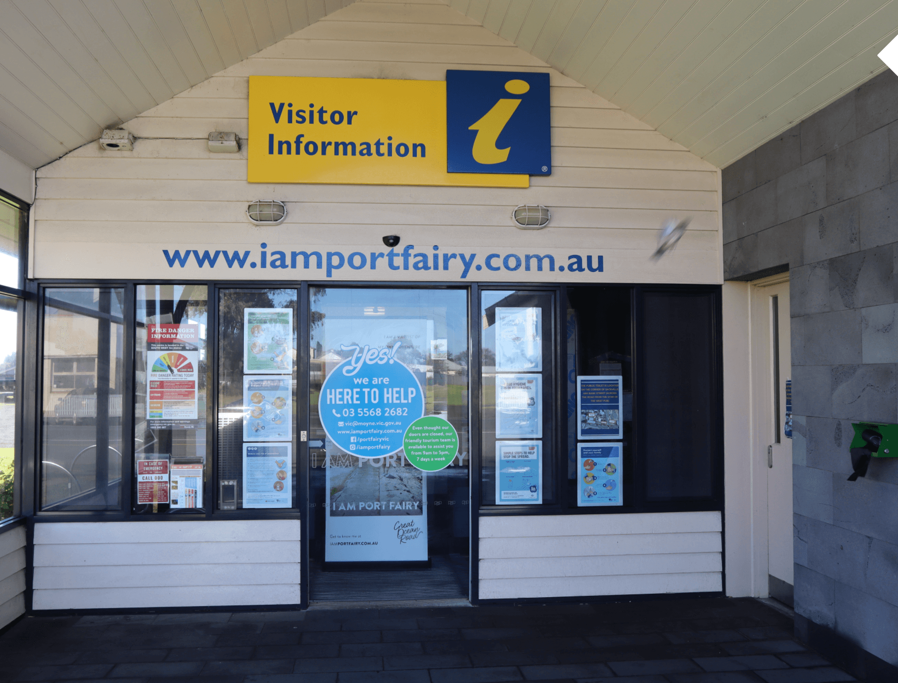
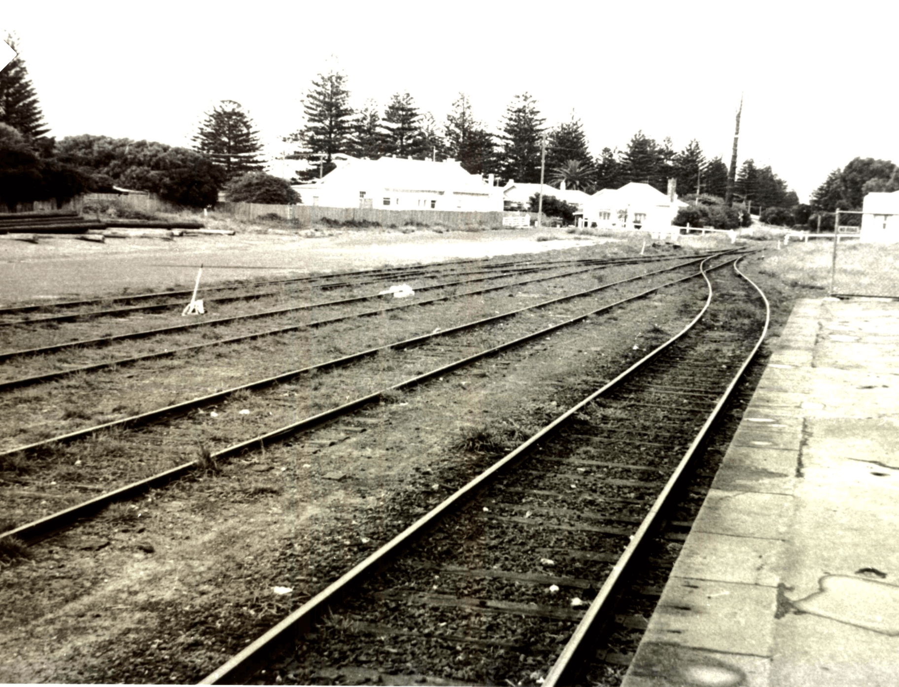 The VIC is situated in Railway Place on Bank Street where the old railway station, shed and railway lines were located. The railway ceased operation in 1977 after being established here in 1890. Look carefully at this photograph showing the railway lines. Notice the platform of the Station. Can you guess where the VIC is located today in this photograph? (Hint: The railway lines cross over Bank Street which is in the background where the buildings are situated).

Before we start our walk it’s important to remember that the first people to live in this area of Port Fairy were the Gunditjmara. Archeological evidence suggests that they lived here for thousands of years before the arrival of Europeans. This Memorial stone near the VIC has the following inscription reminding us about what happened to many of the Gunditjmara soon after the arrival of European settlers:
“In memory of the thousands of Aboriginal People who were massacred between 1837 and 1844 in this area of Port Fairy. Today we pay our respects to them for the unnecessary sacrifices they made. Your spirit still lives on within our people. Wuwuurk.”

This signage tells us that a wealthy Irishman by the name of James Atkinson was granted 5,120 acres of land in this area of Port Fairy for the very reasonable price of one pound per acre.
Atkinson also bought land in other parts of the colony — he had serious “land hunger”.
In 1843 Atkinson started drawing up plans to build a town he called Belfast, now known as Port Fairy.

Let’s start our tour by walking down Bank Street towards Gipps Street.
Gipps Street is named after Sir George Gipps who was Governor of New South Wales from 1839 to 1846. It was Gipps who granted Atkinson his Special Survey of 5,120 acres and the rest as they say is history!
The red building at the end of Bank street, seen in the photograph, is Goble’s Mill House.

Joseph Goble was one of the most successful millers in the town. He built his mill in 1866 and operated it until 1871 when he leased it to another miller. Unfortunately, growing wheat in the area became increasingly hampered by fungal diseases. Eventually flour mills closed down and the buildings were used for other purposes. Goble’s Mill House operated as a Cheese and Butter factory until 1939, as shown in the photograph.

Goble’s Mill House has become an Essendon supporter’s shrine. Why? Essendon and AFL legend John Coleman was born in Port Fairy and spent his early childhood years here. His father managed the Cheese and Butter factory that operated in Goble’s Mill House in the 1930s. The Coleman family lived in a nearby house on Gipps Street. Here’s a photograph of John Coleman in action playing for Essendon. He kicked an incredible 537 goals in only 98 games for Essendon and 49 goals when he played for Victoria. In one game, he kicked 18 goals against Hawthorn. Apparently, as a young boy John Coleman kicked his very first ever goal here in Port Fairy — right through the left window on the ground floor of Goble’s Mill.
Image Source: Public Domain
 Another well-known Port Fairy mill was the Moyne Steam Flour Mill. Originally the mill was a four-storeyed bluestone building. It was located on the southern boundary of King George Square and is shown in the background of this photograph. The remains of the building can still be seen there today. After its days as a flour mill ended it was used to host balls, theatrical performances and a wire walking exhibition. Today the Moyne Steam Flour Mill and Goble’s Mill House are used for accommodation.
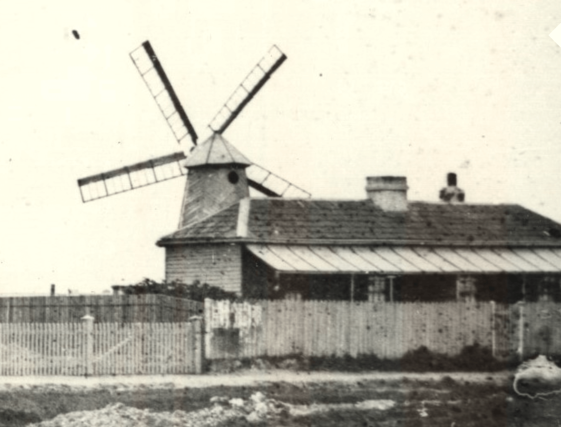 From the mid 1840s onwards, some millers built and operated windmills to grind wheat into flour. The wooden post mill shown in this photograph, circa 1861, was located near the south end of Gipps Street and was built in 1847 by John Griffiths, the famous whaler and pioneer. Windmills were also used to pump water. In earlier times, shallow wells and water tanks were used as a source of water; however, by the mid 1880s most hotels and large private houses and farms had their own windmills. The skyline of Port Fairy gradually filled with the sails of windmills – as commonly seen as TV antennae and satellite dishes are today.
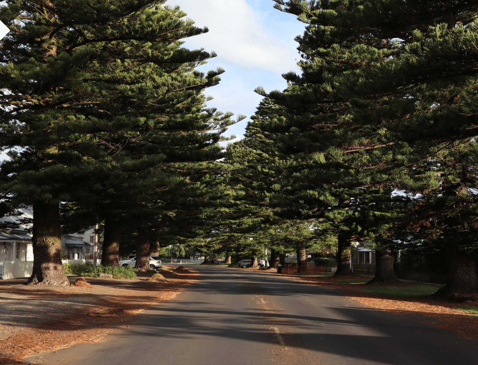 Walking south along Gipps Street we can see Norfolk Island pines lining either side of the street. The early settlers cleared the town land and surrounding area of all the vegetation. However, by the 1870s some street-tree planting had been considered by the Council. However roaming goats ate the saplings and the Council wasn’t prepared to pay for tree-guards! Eventually Norfolk Island pines were planted along Gipps Street around 1900.

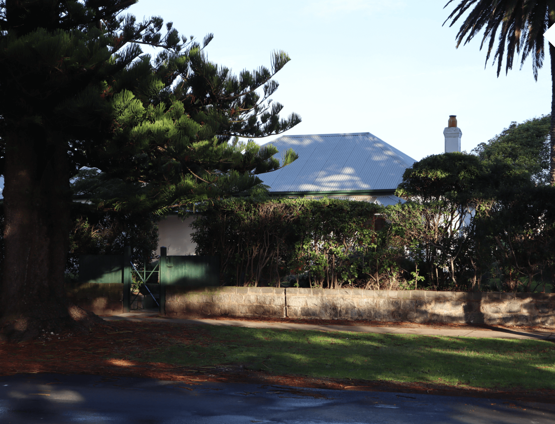
The first Norfolk Island pine was planted behind the house pictured below, at 64 Gipps Street, in 1848. This particular pine tree became famous as one of the oldest of its kind in the colony and was used by the town’s fisherman as an important nautical marker when returning home from a day’s fishing in the ocean.
 But why is it no longer there?
 The odd-shaped pole you can see in this photograph was what was left of this famous Norfolk Island pine after it was “pruned”, prior to being cut down. This photograph gives you a close look at this sad and sorry sentinel in its last days. The town is still pining for that lost tree!
By-the-way the Glaxo Social Club building on Bank Street in the foreground is now occupied by the 1st Port Fairy Sea Scouts.
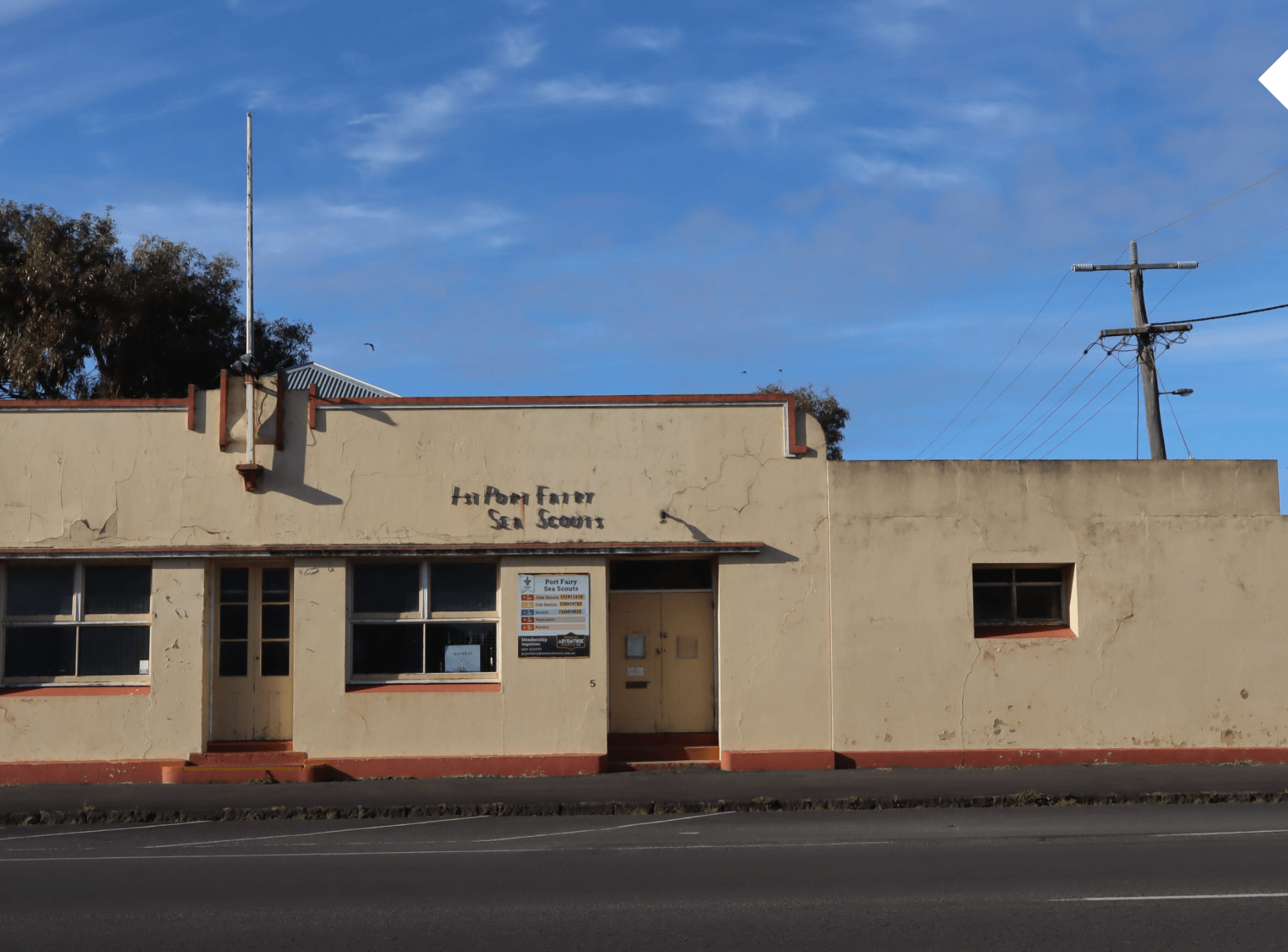 The 1st Port Fairy Sea Scouts was established in 1950. Today, the troop organizes activities for Joey Scouts (5-8yo), Cub Scouts (7-11yo), Scouts (10-15yo), Venturers and Rovers. A varied program of water and land based activities provide local young people with valuable opportunities for community involvement while developing personal and leadership skills within a team environment. Their headquarters at 5 Bank Street is shown in this photograph.
 63 & 61 Gipps Street: Notice something odd about these two prefabricated houses from the 1850s? Yes — they share a chimney and if you look carefully at their weatherboards they are of different widths. Building materials were scarce in the 1850s (particularly bricks).
 59 & 57 Gipps Street: For many years, the river bank was not a desirable place to live. Children who did live there were often referred to as “river rats” as there was always a problem with vermin along the river bank.
Today it’s a different story and properties along the river bank sell for seven figure sums.
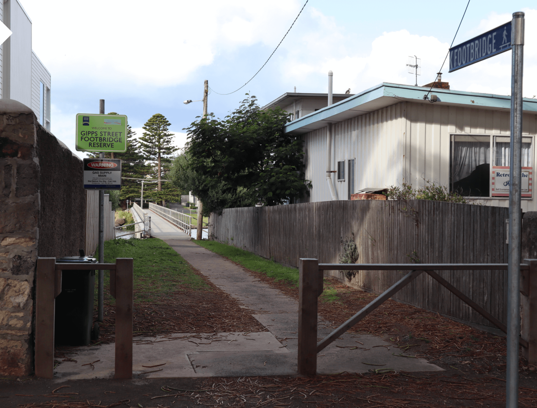 Next to number 57 Gipps Street is the entrance and pathway leading to the footbridge over the Moyne River.
 The reason for the warning sign on the left is that the river is quite shallow near the bridge.
However, in the early days of the town there was another danger — sharks! Sharks were often seen cruising up and down the Moyne River feeding on the rubbish that the settlers dumped into the river.
 Looking north from the footbridge towards the car bridge provides a spectacular view of the Moyne River.
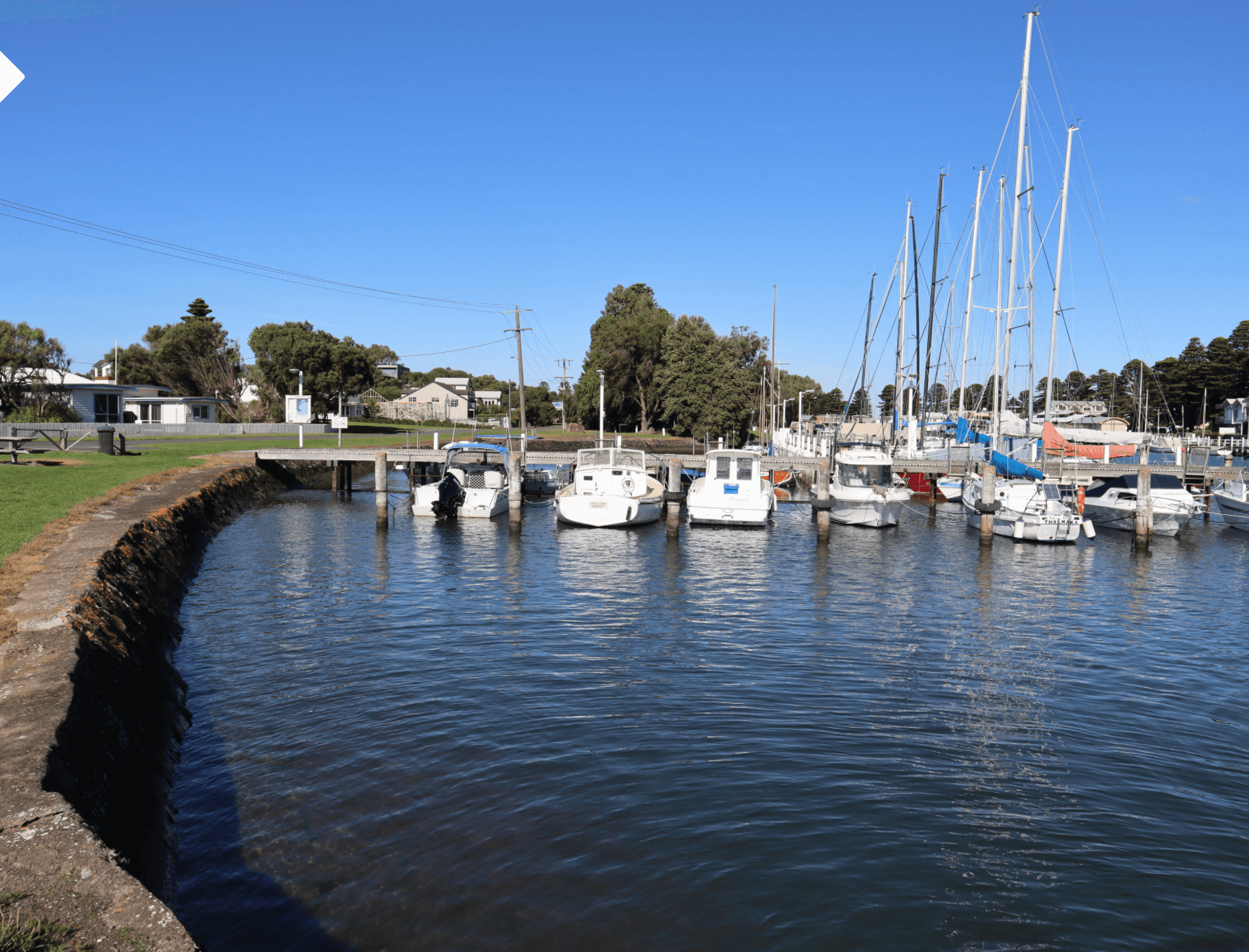
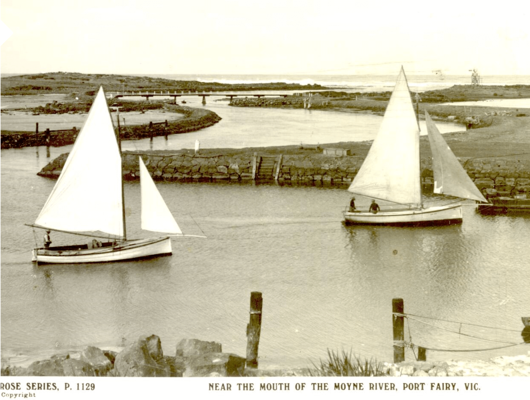
 Looking south towards the wharf provides an even more spectacular view of the Moyne River. Picture postcard perfect.
 Looking towards the east bank of the river you can see that a big chunk of the river bank has been cut away.
In the days when large steam packet ships sailed up and down the river, the river wasn’t wide enough to allow the ships to turn around easily. So a “big bite” was taken out of the river bank and called a “swinging basin”.

Famous steam ships like the SS Casino and SS Coramba sailed up the Moyne River and were able to turn around using the ”swinging basin”. In this photograph, the SS Casino has just turned around in the “swinging basin” and is sailing back down the river towards the mouth of the Moyne River. It is about to pass the wharf and several fishing boats. The curved roofed Customs Shed can be seen in the background.
 Turn right from the footbridge and walk along Griffiths Street past the “swinging basin”.
Take a look back at the footbridge we’ve just walked over. Not the most aesthetically pleasing bridge … if we’re being honest.

Apparently, a previous bridge was more attractive but it was destroyed during a major flood in 1946. During this flood, the river level rose by about three meters to the height of the bridge. In the background of this photograph you can see that a section of the footbridge has been swept away by the raging river water.
 Continue walking south along Griffiths Street to Charles Mills Park.
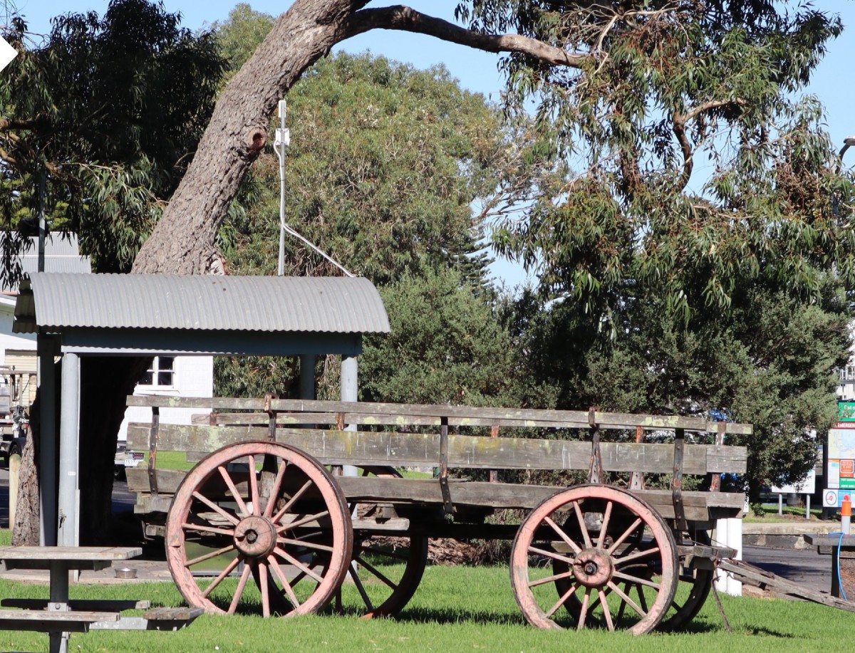
This old bullock wagon in Charles Mills Park has seen better days.
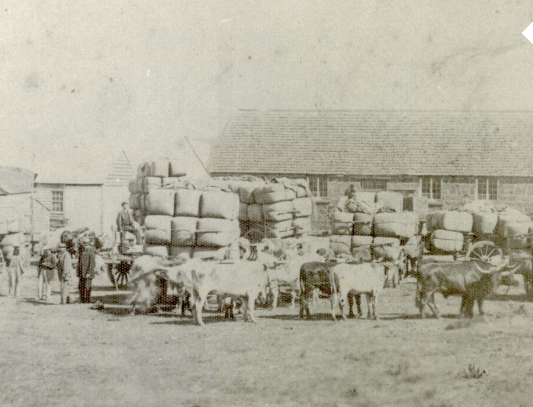 But in the early days of the town these bullock wagons were vital to the trade on the wharf as they were the principle means of transporting cargo to and from the wharf. The photograph shows a number of bullock wagons ready to transport bags of wheat and wool.
 The boat launching slipway is usually a busy place.
The Moyne River is one of the most popular recreational fishing places in Victoria and has been for a very long time, as can be seen in the second photograph below.
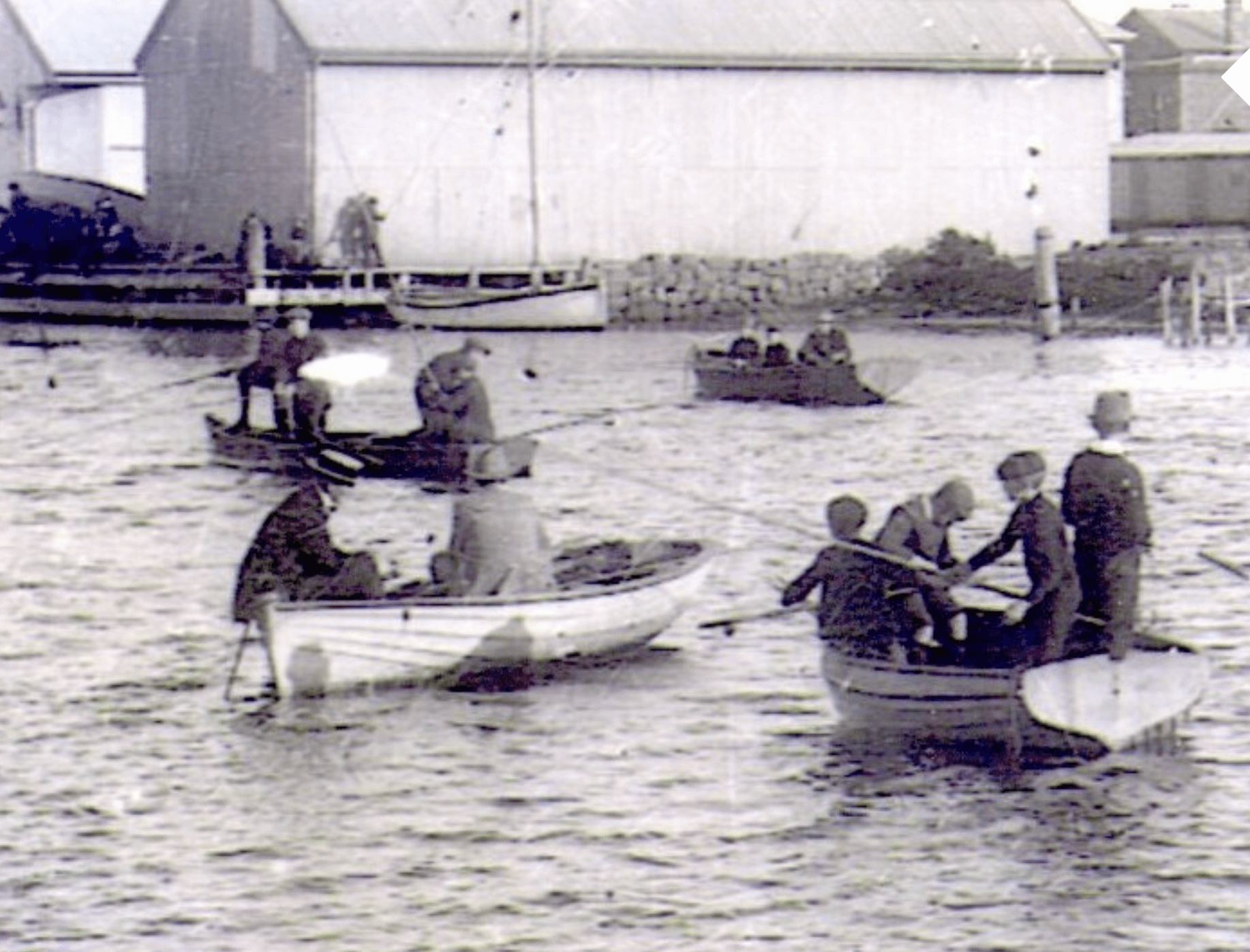 Looks a bit crowded on the river – reckon there would’ve been a few tangled lines.
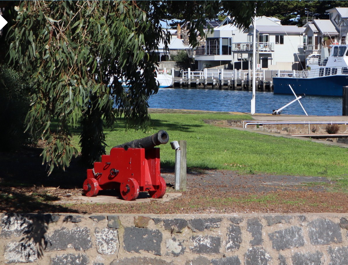 Further down Griffiths Street you’ll see this impressive little cannon — looking military smart in its red colour. This particular cannon is a replacement for a similar cannon that mysteriously disappeared many years ago in 1999. The original cannon was recovered from a ship wreck in 1865.
Not sure what sort of damage our little red friend could inflict though. Maybe chip some paint off a Russian warship? (it wouldn’t really be expected to cause any damage — it’s actually a 6-pounder signal cannon!)
 The long lost “brother” of our little red cannon wasn’t always found on the river bank or Battery Hill. Where else did the little cannon spend its time? There it is, in front of the Lecture Hall, looking slightly out of place. But what’s it doing there? Guarding the Lecture Hall and Library? From what?
 Continue walking along Griffiths Street.
Here’s a very interesting early postcard of Port Fairy taken from the top of Battery Hill showing where you’re walking on Griffiths Street along the Moyne River. Can you see Griffiths Street? (Hint: It’s not there!) Notice the line of warehouses along the river on the opposite side of the river — very different from the modern renovated houses that are there today. The train accessed the wharf in front of the Customs Shed through the gap that can be seen in the warehouse. Two railway carriages sit next to the Customs Shed. Other familiar buildings seen in the distance are the Customs House, Court House, Bank of Victoria, Post Office and Bank of Australasia. But here’s a challenge — can you spot a cannon and how many windmills are visible? By-the-way, notice the size of the Norfolk Island pines. The two buildings shown in the next photograph can be seen in this photograph exactly where they’re found today.
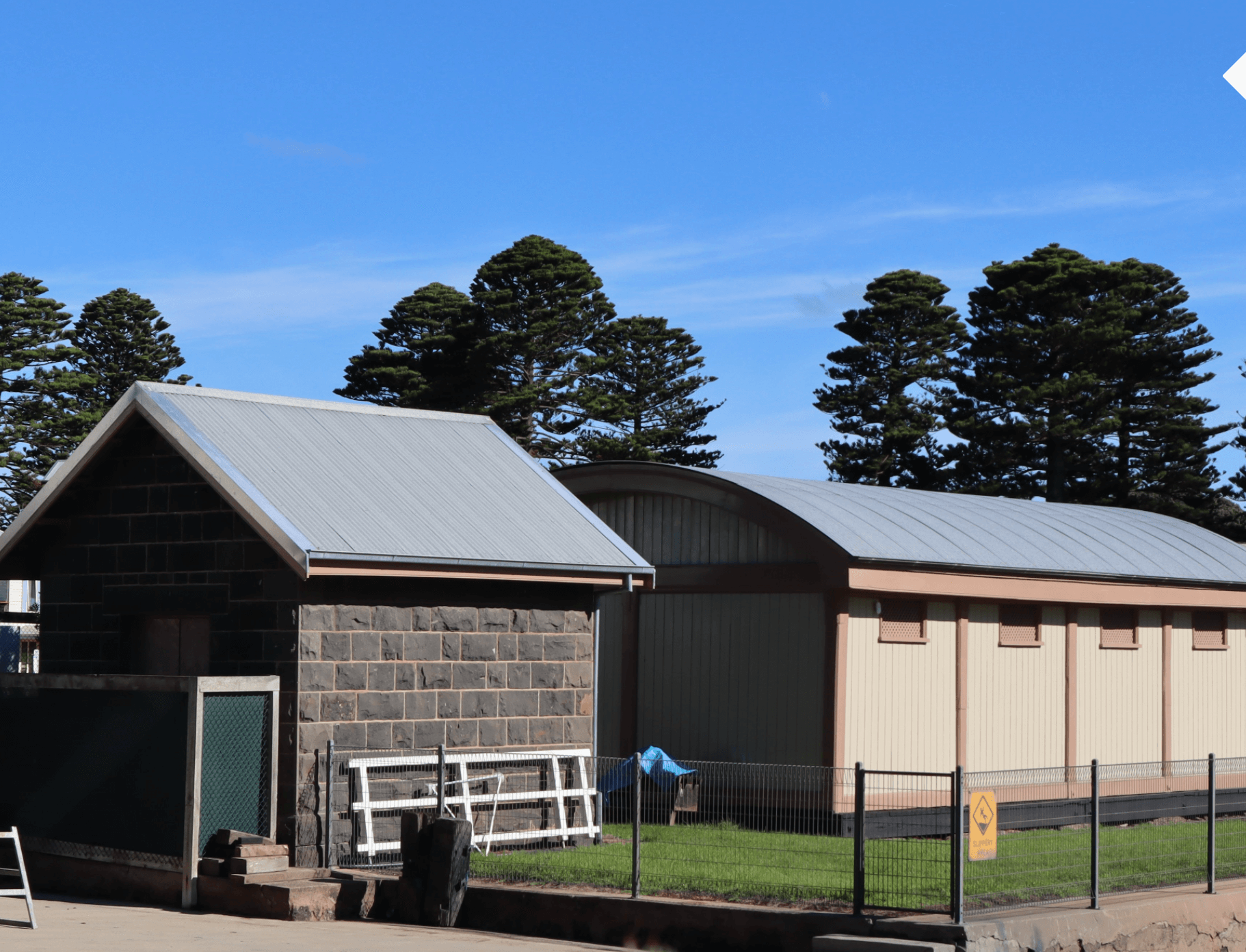 The curved roofed building on the right in this photograph is the Lifeboat House and contains a lifeboat, shown in the second photograph below, that arrived here in 1857.
 Although constructed as a “self-righting” lifeboat with an effective drainage system of valves and able to carry up to forty survivors, the lifeboat was never used in any rescue attempts. The lighter whaleboat was preferred. Apart from being easier to manoeuvre, the whaleboat required a crew of only five or six compared to fourteen for the lifeboat. An alternative method used for rescuing people from an ailing ship in the bay can be found in the bluestone building on the left in the previous photograph. It’s the Rocket House which houses the rocket launcher apparatus, as shown in the next photograph.
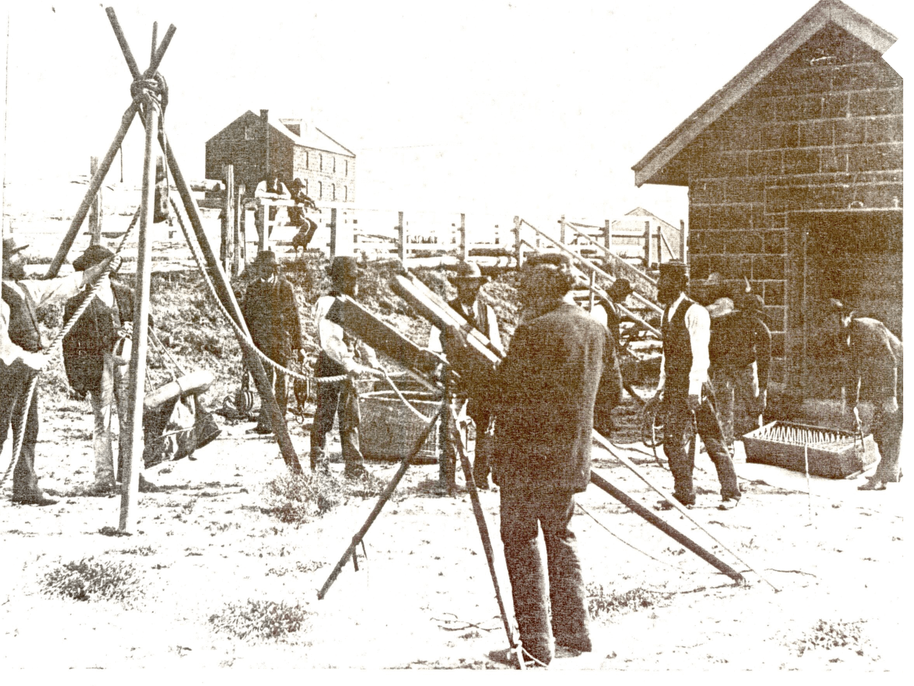 The rocket launcher apparatus was invented in 1807 by Captain George Manby. Basically, the rocket launcher method involved firing a rocket, with a rope attached, out to sea in the hope of it landing on the ailing ship. If it did, a heavier rope would follow with a pulley attached to a life-ring called a “breeches buoy” which had a large canvas bag with holes in the bottom for legs. Passengers and crew would then be transported to the beach in the wildest kind of ‘flying fox’ ride imaginable! But there were limitations. The rope was only 500 yards long (about 450m) and it was a “hit or miss” situation, made especially difficult if the rescue attempt happened at night. The photograph shows volunteers practicing with the rocket launcher equipment next to the Rocket House.
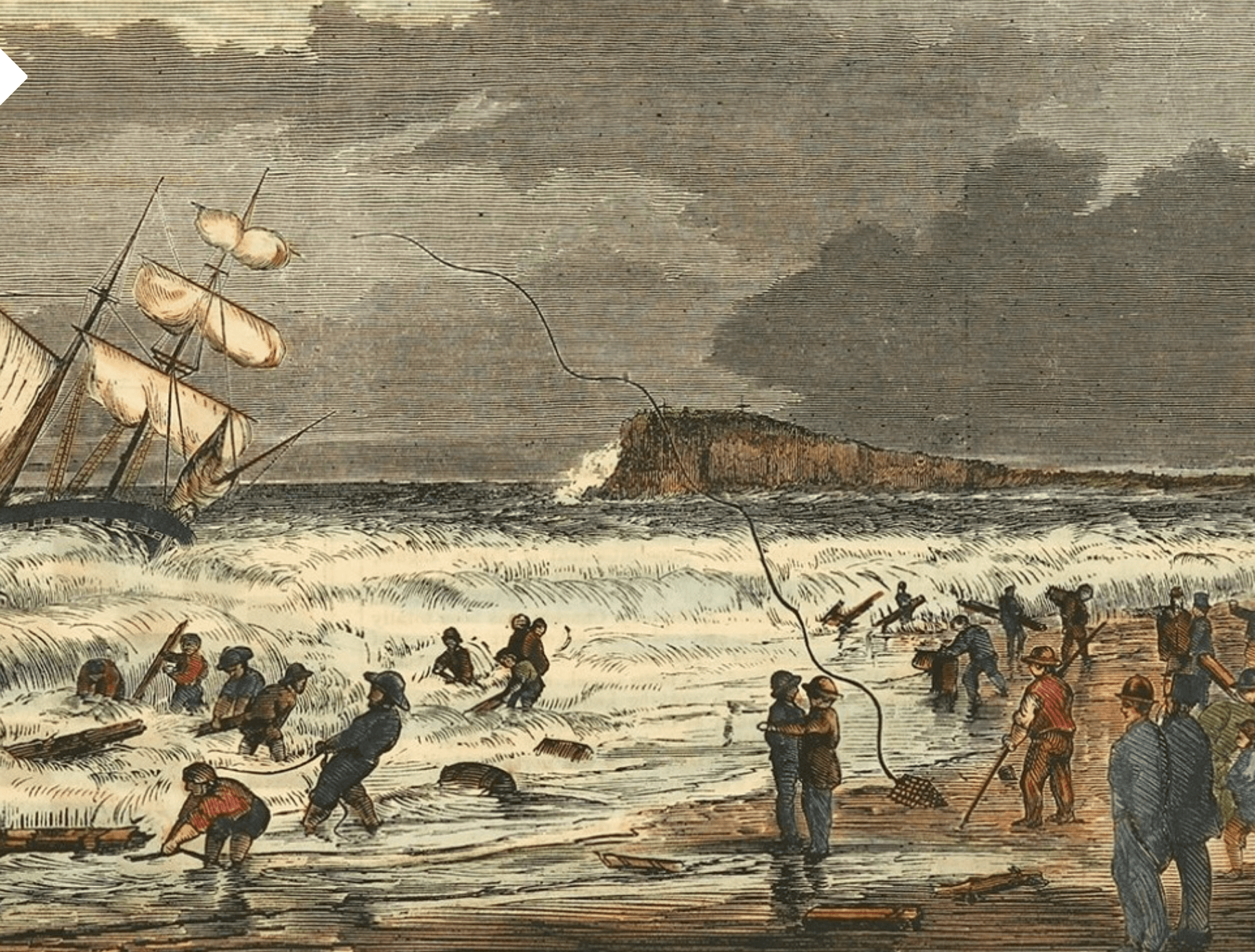 In 1866 the schooner Lismore was wrecked while on its way from Newcastle to Sydney carrying a cargo of coal. The crew were rescued from the wreck by means of the rocket launching apparatus. The newspaper engraving shown here is of a scene from the beach showing the rope being launched towards the Lismore.

Keep walking along Griffiths Street.
Finally — here’s Battery Hill.
 In 1859 the government flagstaff was erected on this conspicuous landmark which became known as Flagstaff Hill. Flagstaff Hill was an important signaling and tidal aid for ship Captains sailing into Port Fairy Bay looking for safe anchorage. The port was located in the bay at this time, not in the river. With the addition of a second 80-pounder cannon in 1885 and the artillery battery being built on Flagstaff Hill the name changed to Battery Hill.
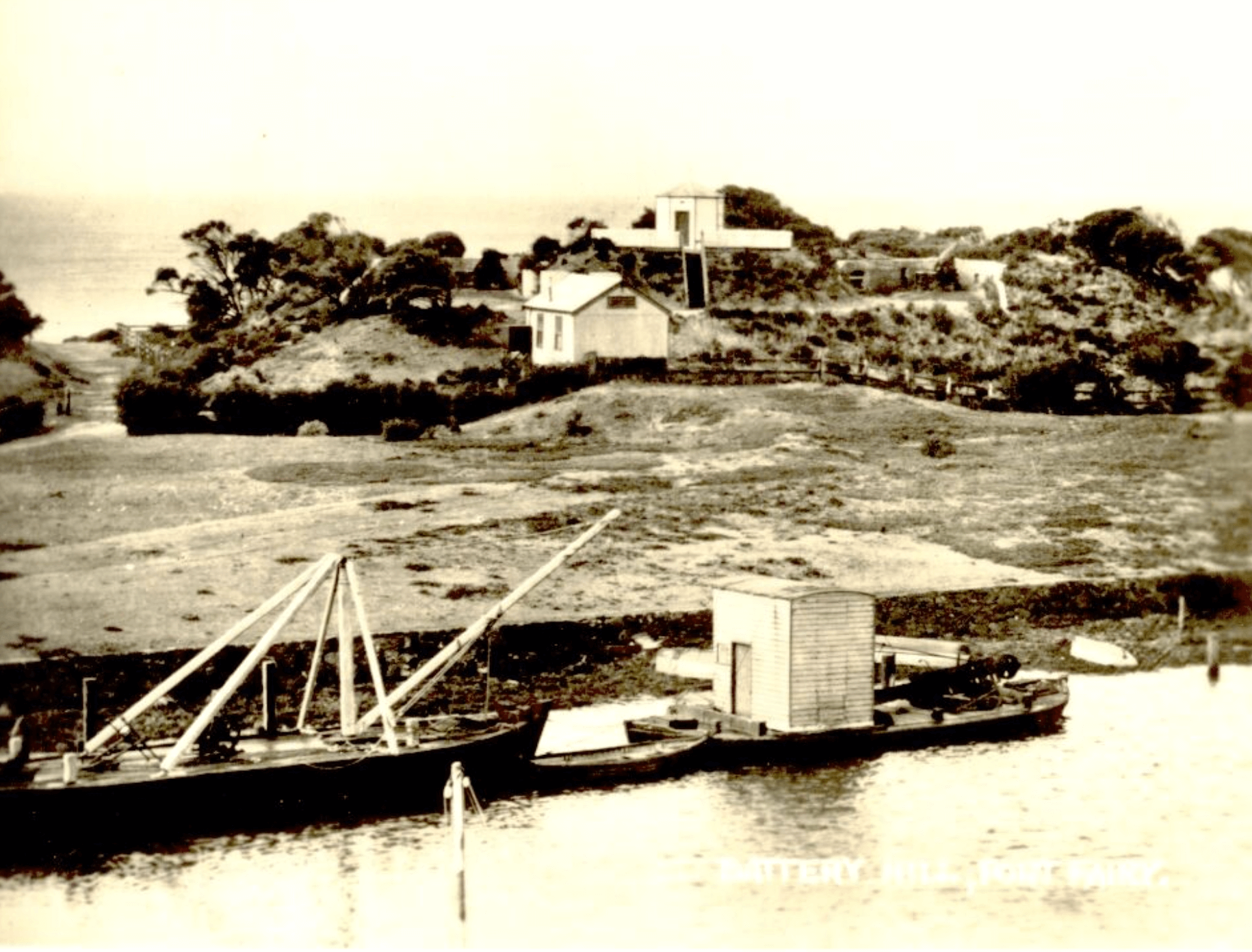 This photograph was taken from the west bank of the Moyne River and looks across the river towards Battery Hill. There are a number of interesting features to note. On top of Battery Hill a small octagonal observation hut can be seen. This was used by the Harbour Department as a lookout (to watch out for any Russian warships!). Below and to the right of the lookout is an 80-pounder cannon on an iron carriage positioned within a concrete emplacement. The cannon is still there today.
 This photograph shows a closer view of the observation hut on the top of Battery Hill, described in the previous photograph. Good to see our trusty little watchdog seems to have everything under control and isn’t barking up the wrong tree about a Russian invasion.
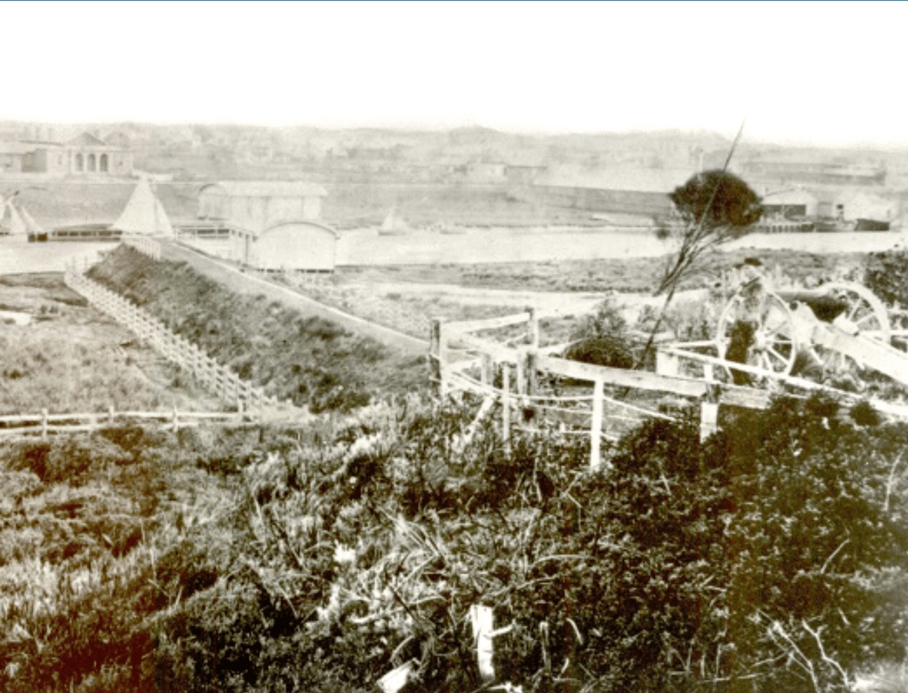 This photograph, taken from near the observation hut, shows a cannon pointing towards the river and not out to the bay. Can you spot the Court House, Customs House, Customs Shed, Lifeboat House and Merrijig? The built-up path that can be seen below the cannon is the remains of the foundation for a tramway line that connected the bay to the river. But why is that cannon pointing towards the town?
How can you tell this is an earlier photograph of Port Fairy than the one in the postcard shown previously? (Hint: look for the Rocket House, Norfolk Island pines and the number of buildings along the river)
 Maybe the cannon seen in the previous photograph was all about “keeping an eye out” for any suspicious warships docking at the wharf on the Moyne River, as shown in this photograph (by the way, the ship isn’t Russian). The curved roofed Lifeboat House can be seen on the left in the background.
 Walk up the steps to the top of Battery Hill.
Panoramic views of Port Fairy Bay from the top of Battery Hill can be enjoyed. Part of Griffiths Island can be seen close by, beyond the river mouth, and Warrnambool in the far distance. The extinct volcano, Tower Hill, is just out of view to the left.
 Here’s a closer look at the 80-pounder cannon on its iron carriage within a concrete emplacement at the top of Battery Hill. It’s actually called an 80-pound rifled bore muzzle loading cannon. This basically means it’s a big cannon firing a big shell. The 80-pound description doesn’t refer to the cannon’s weight, which is 4 tons. The description refers to the size of the shell it fires — 80 pounds or 36 kilograms. The rifled bore (or barrel) of the cannon causes the shell to spin during its flight which increases accuracy. “Muzzle loading” means the shell is loaded from the front of the cannon down the barrel. However, before the shell is loaded, 9 kilograms of gunpowder is pushed down to the base of the barrel and acts as the charge to fire the shell. A fuse is lit and travels down a vent hole on the side of the cannon and ignites the explosive, causing the shell to be fired. The shell travels out of the cannon at a velocity of 400 metres per second and can travel up to about 4 kilometres.
 Here’s a postcard showing a 68-pounder cannon positioned on a wooden-wheeled trolley. This kind of trolley allowed coastal artillery cannons to be manoeuvred around to allow for changes in distance and direction when firing cannon balls. Interestingly the cannon was located in the Botanic Gardens.
 The type of wooden trolleys supporting cannons shown in the previous postcard were inadequate when the size of the cannons increased to 80-pounders. A metal carriage and slide was necessary to support heavier cannons, as shown in the photograph. This arrangement allowed the cannon to be swiveled on iron rails when changing the direction of shell fire and the elevated metal slide allowed the cannon to recoil and return to its original position after firing.
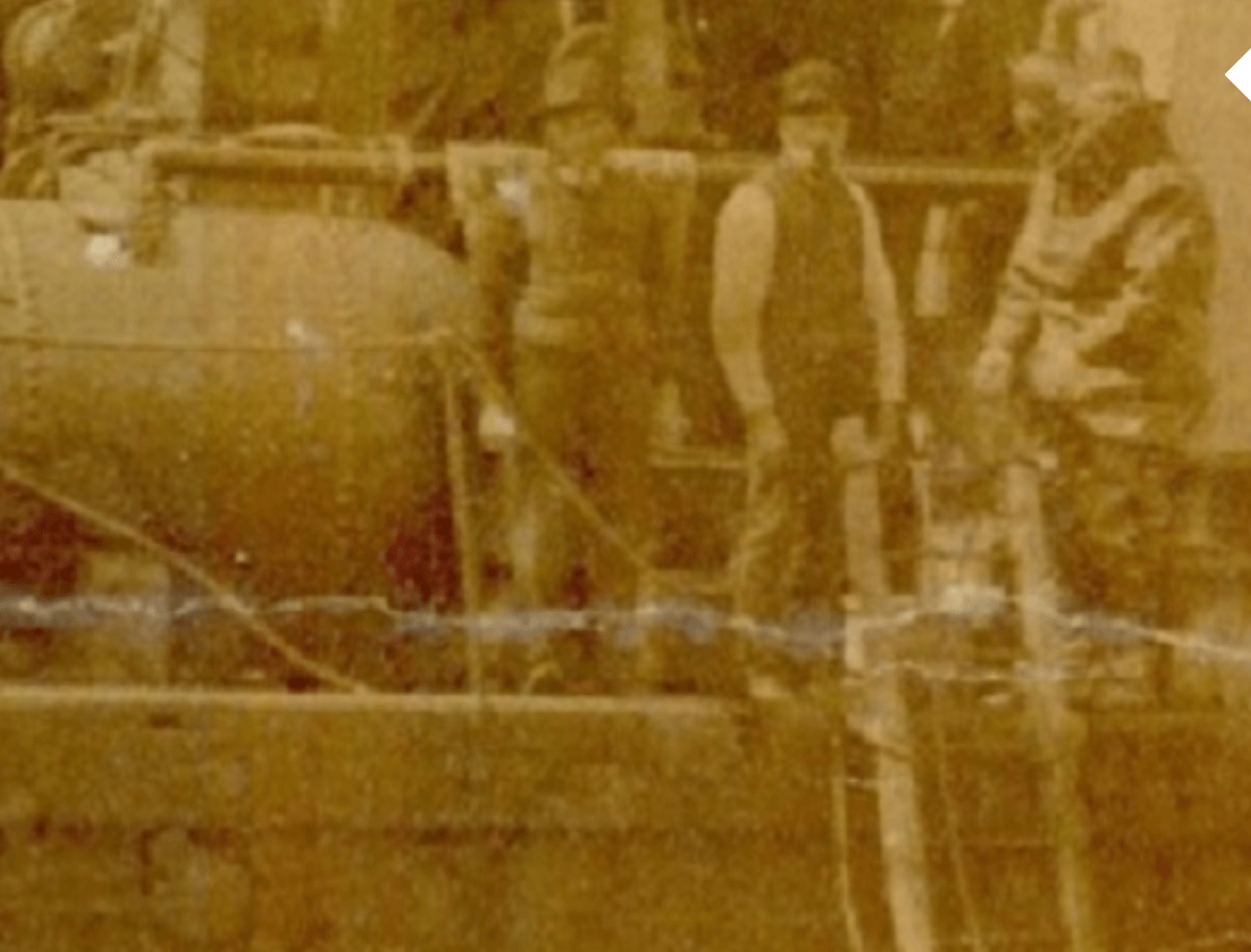
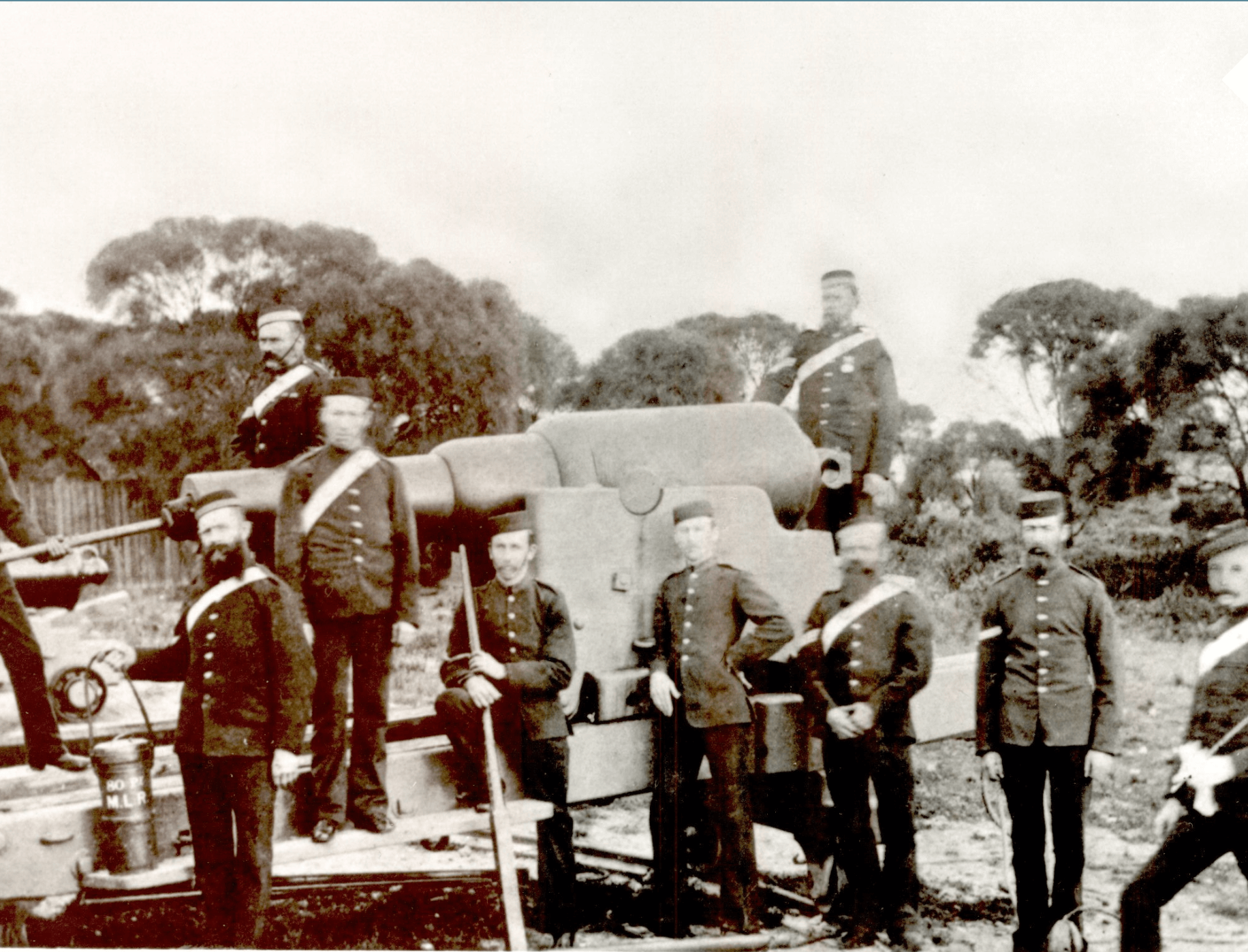 Who operated and maintained these cannons? The Belfast Volunteer Corps. This photograph shows a group of the volunteers with the Armstrong muzzle loading rifled 80-pounder cannon. The Corps was established in 1859. The volunteers participated in parades, drill instruction, tactical exercises, artillery competitions and camps. The tactical exercises were taken very seriously. Apparently, during one night’s tactical activity, a sentry on duty acting for the defensive force was distracted by a pretty servant girl’s offer of “supper indoors” allowing the attacking force to sneak past and claim victory!
 Who was in charge of the Belfast Volunteer Corps? The famous Captain John Mason, seen in this photograph. John Mason was an extraordinary man who contributed in many different ways to the development of the township of Belfast. He began as an innkeeper at The Stag, and then became a carpenter, stone-mason and architect to name but a few occupations from his skill set. He was also a member of various community organizations. He built the Rosebrook Bridge, the first Post Office in Bank Street, and the Court House, Telegraph Office and many of the larger shops in the town. Although articulate he was known to be easily irritated. Apparently, John Mason had no sense of humour whatsoever and was always stony-faced. Well, that’s not really surprising — after all, he was a stone-mason.
 This photograph shows a shelter built for four cannons – two 68-pounders and two 32-pounders. Both types of cannon were mounted on wooden carriages. These are smaller cannons than the 80-pounder cannons and fired cannon balls not shells. In 1867 the first cannons arrived in Port Fairy — the two 32-pounders. They were originally placed in what is today the Battery Hill carpark. The size of each successive cannon gradually grew with 68-pounders arriving in 1874 and by 1889 an 80-pounder arrived. The Defence Department sold them to the Port Fairy Borough for just one pound each. But where are the cannons today? Are they outside the Lecture Hall? No – they’re currently being repaired and will be returned to Port Fairy later this year.

The size of the cannon balls fired by these 68-pounder and 32-pounder cannons are, not surprisingly, 68 pounds (30kg) and 32 pounds (14kg) respectively. A 32-pounder and 68-pounder cannon could fire their cannon balls about 2.5 km and 3km respectively.
Cannon balls were made of cast iron. A typical cannon ball is shown in the photograph. Iron was superior to lead — it was cheaper, lighter and harder so iron cannon balls were easier to transport and could be fired further than lead cannon balls and cause more damage.
The strategy of firing cannon balls at an enemy ship was to hit the wooden structures of ships and cause many splinters of wood to fly off from the impact site and injure or kill the enemy sailors.
Cast iron cannon balls could also be hollowed out and packed with explosives or roasted hot before firing to cause fires on enemy ships or cause smouldering that required enemy crew members to put out any fires thus reducing the number of enemy crew available to retaliate.
Image Source: USS Constitution Museum Collection
 In the late 1800s artillery competitions were organised between Volunteer Corps from different towns to find out how far and effectively they could shoot the cannon.
There is a report from The Warrnambool Standard newspaper from 1894 that tells of such a competition between the Volunteer Corps from Port Fairy, Geelong, North Melbourne, Portland and Warrnambool. A target would be placed in the bay and teams would get marks for how quickly they could prepare and fire the cannon and how close they could get to the target.
Not a time to be enjoying a relaxing sail in the bay.
 Walk back down the steps to the river.
This is a picturesque spot to take a break from our walk and enjoy the vista of the Moyne river and wharf.
Also take the time to contemplate the real concern held by the colony about a possible Russian invasion. Ironically, the Gunditjmara probably held similar fears as they watched the Europeans arriving in the area. But they didn’t have any cannons to dissuade those “visitors”. Fortunately for the colony the Russians didn’t turn up so none of the cannons had to fire a single shot in anger.
 Keep walking along the river bank towards the mouth of the river.
Looking back along the Moyne River you can see Martin’s Point. The grove of Norfolk Island pines in Martin’s Point is a rarity in this region – the trees were planted in 1939.
 Walking past Martin’s Point towards the river mouth the southwest passage comes into view. This passage directly connects the ocean with the river. Today a causeway built across the passage links the mainland with the training walls providing access to Griffiths Island. But the current causeway interferes with the connection between the river and ocean and affects sand deposition on the East Beach. An earlier bridge-like causeway, as shown in the background of this postcard, maintained that connection. Although Martin’s Point looks bereft of buildings or vegetation, prior to the Norfolk Island pines being planted, it wasn’t always like that, as shown in the next photograph.
 One feature of Martin’s Point not shown in the previous postcard is the Port Fairy Preserving Factory, also called the Rabbit Factory. This factory operated on Martin’s Point producing cans of tinned rabbit meat as well as fish, poultry and vegetables. The factory is shown in this photograph.
Rabbits were in plague proportions prior to the 1946 flood, but as a result of the flood vast numbers drowned!

Apart from the silt and shallowness of the Moyne River, ships trying to sail into the mouth of the river were blocked by bluestone reefs. Blasting away these bluestone reefs required gun powder (dynamite). The gun powder was carefully stored in the bluestone Powder Magazine building, shown here. It was built in 1861 and the stored gunpowder was not only used for rock blasting but also for civil works and tree blasting. The building has interesting design features. Its brick ceiling is semi-circular in shape. This meant that if the gunpowder did explode most of the damage would be to the ceiling and roof, not the walls, thus reducing the danger to people. For extra protection in the event of an explosion, it was built in a low-lying area of the sand dune. In order to prevent an explosion caused by lightning, metal rods were attached to the building to act as lightning conductors to divert lightning harmlessly into the ground.
Not a place to have a quiet ciggy! You might go up in a puff!
 This photograph shows a diver about to enter the water near the mouth of the Moyne River to lay the dynamite charges to blast apart the bluestone reefs.
 The extended entrance of the Moyne River into Port Fairy Bay was created by two training walls, as shown in the photograph. The training walls were constructed about 1870. Extending the river into the bay helped to control the silting up of the river mouth and enabled ships to more easily sail up the river. Tower Hill, the extinct volcano, can be seen in the distance.
 It’s time to head back in the direction of the VIC. But let’s go back a different way.
By taking the track to the right, as shown in the photograph, you can discover and explore the famously beautiful East Beach!
 And the second photo shows the start of East Beach.
Battery Hill can be seen in the background.
 Walk along the beach and you’ll come to the cutting shown in the first photograph below.
The cutting in the sand dune below Battery Hill has an interesting story to tell in relation to Port Fairy Bay.
 In the 1860s a pier was built into the bay from here, in front of the cutting shown in the first photograph. Its intended purpose was to connect with a tramline that ran through the cutting, over the sand dune and past Battery Hill to the river.
 But the pier, shown in the photograph, was described at the time as,” perfectly useless.” Why? Because the pier was built in the shallowest part of the bay and large ships couldn’t sail anywhere near it to unload people and cargo.
 Looking north up the beach there are four groynes which have been built into the beach to capture sand and help build up the beach. At different times in the past potatoes, pieces of coal and bottles of rum, gin and brandy were found strewn amongst the groynes and beyond. Where did they come from? Sadly, they came from shipwrecks. There are seventeen or so shipwrecks in Port Fairy Bay. The earliest is that of the Thistle, which sank here in 1837. The Thistle is probably Victoria’s most famous ship. The Henty family sailed in the Thistle to Portland Bay to set up the first permanent settlement in Victoria in 1834.
 Walking further up the beach from the groynes you will come to the Port Fairy Surf Lifesaving Club. The PFSLC was formed in 1924 and has been a very active club serving the Port Fairy community ever since. The club organises a wide variety of activities throughout the year including summer beach patrols, a “Nipper” program for children as well as programs and representation in surf lifesaving competitions, awards, carnivals and ocean swims.
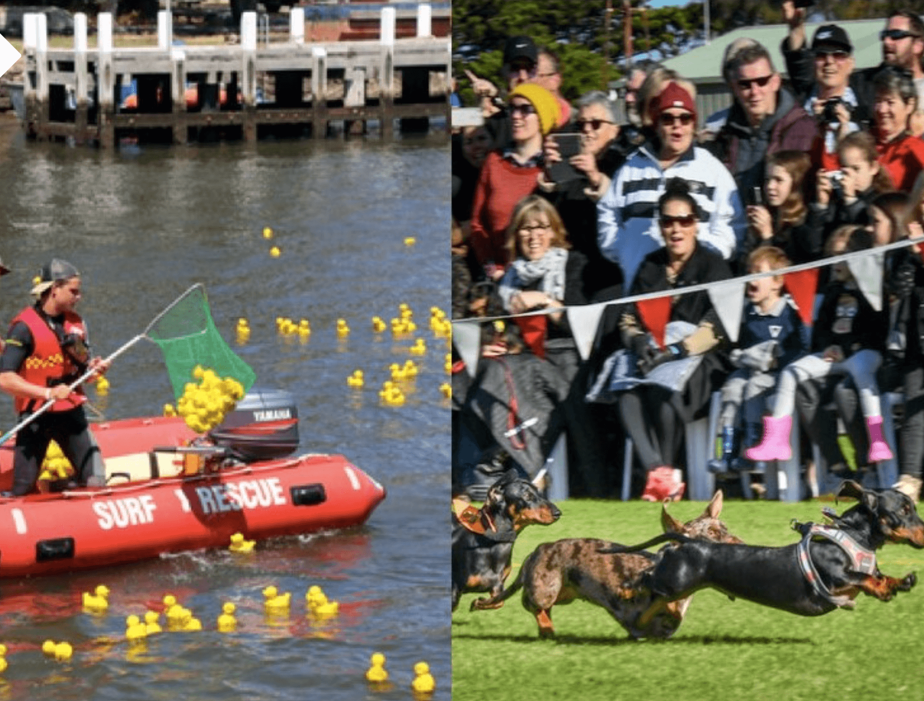 One of the PFSLC’s most popular activities takes place on the Moyne River each New Year’s Day — the Moyne Duck Derby, a keenly contested and exciting event full of thrills and spills. Everyone has a quacking good time watching the ducks “swim” or drift to the finish line. It rivals in popularity with the “Dachshund Dash” during the June Winter weekend. The pair of photographs show some of the ducks and dachshunds competing. Image Source: Victorian collections museum.
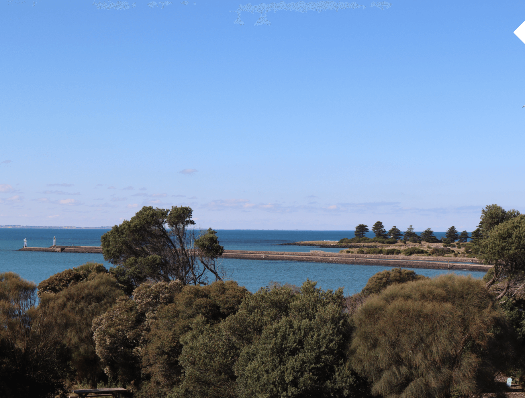
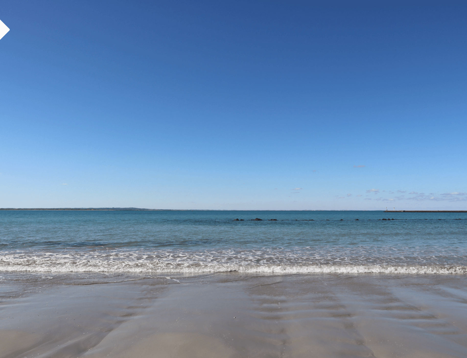
 Looking back towards Griffiths Island a final panoramic view of the bay can be enjoyed — clear blue sky, expansive sandy beach, calm blue waters, and the beautiful Griffiths Island in the background with the lighthouse peeping out!
Doesn’t get much better … or does it?
 Because if you’re game to rise early in the morning you might be able to catch a sunrise over Griffiths Island and be lucky enough to see something spectacular like this!
This completes the Battery Hill Tour. Port Fairy is fortunate to have such a rare battery collection of cannons with their metal and wooden carriages and emplacements on Battery Hill. Most of the artillery pieces from the 1800s in Europe were melted down and their carriages and slides destroyed.
I hope you enjoyed this brief history tour of Battery Hill and surrounds and had a bit of fun along the way. Call the Port Fairy Visitor Information Centre now to book your tour to Battery Hill. The following links will take you to the pictorial or virtual tours of the town and the wharf.
There is a popular cafe and fish and chip shop nearby to the SLSC if you feel like taking a well-earned rest and relaxing either indoors or outdoors on the stone seats while taking in the stunning views of Port Fairy Bay. Walking back to the VIC along Griffiths Street you might like to call into the Botanic Gardens and enjoy some views of the Moyne River upstream from the car bridge which was built in 1902. Enjoy walking and exploring Port Fairy — either on foot or virtually.
The narrative, descriptions, historical information, recent photographs and newspaper engraving supplied by Glen Foster, Volunteer Tour Guide at the Port Fairy & Region Visitor Information Centre. Historical photographs and postcards supplied by the Port Fairy Historical Society. Other photographs as referenced. Further reading: “Port Fairy — The First Fifty Years” by J. W. Powling; “The Belfast Fantasy” and “Port Fairy — The Town That Kept Its Character” by Marten A Syme; “Guns & Cannon along Victoria’s South West Coastline”: a pamphlet produced for the City of Warrnambool and the Moyne and Glenelg Shires by Heritage Matters Pty Ltd; “Some Shipwrecks of Port Fairy Bay — A Guided Walk” by Stan Evans.
Sign up to get the latest deals, tours & events along the Great Ocean Road
Great Ocean Road Regional Tourism acknowledges the Traditional Custodians of the Great Ocean Road region the Wadawurrung, Eastern Maar & Gunditjmara. We pay our respects to their Elders, past, present and emerging. We recognise and respect their unique cultural heritage and the connection to their traditional lands. We commit to building genuine and lasting partnerships that recognise, embrace and support the spirit of reconciliation, working towards self-determination, equity of outcomes and an equal voice for Australia’s first people.